2nd QUARTER 2003
EOG PEOPLE
B-5
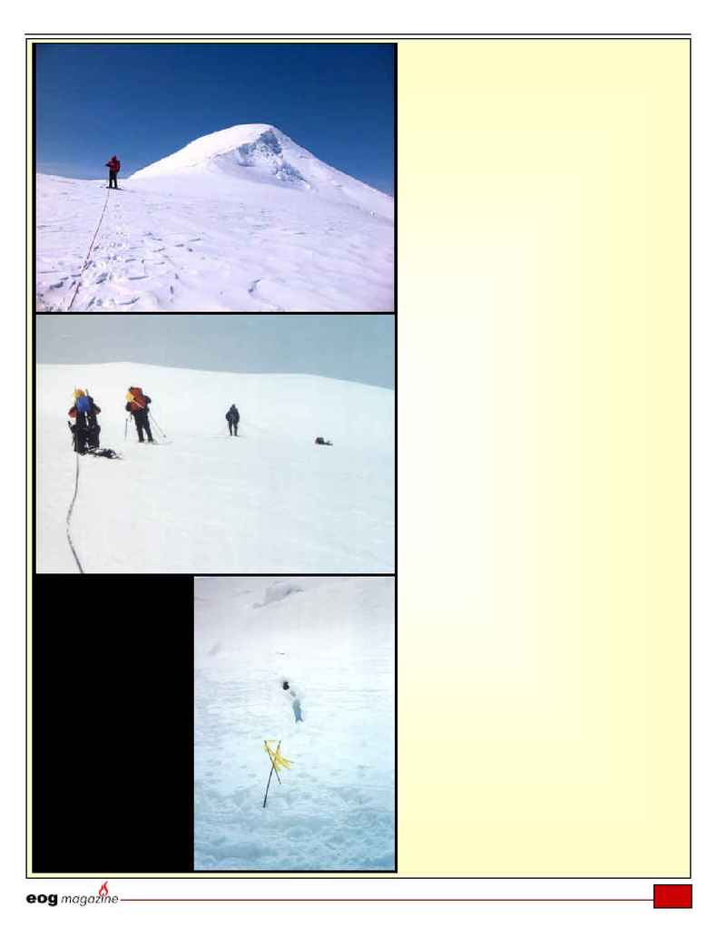
Above: The crew members
use ropes to get up and
down the mountain and to
prevent a fatal fall.
Right: One of the biggest
dangers of climbing Mt.
Bona are the dangerous
crevasses. As illustrated in
this photo, they are hard
to see until you are right
on top of them. The crew
marked this small
crevasse with a flag so
they will remember it on
the way back down.
Continued from previous page
back to camp by 7 p.m., no sweat. We can just
follow the wands the whole way. They are 150
feet apart on the upper mountain, and perhaps
500 feet apart on the plateau. And we have a
Global Positioning Satellite (GPS), with Camp 2
set as a waypoint.
5:30 p.m. Day 7. Dick has fallen a couple of
times, as the pace of the day has gotten to him a
bit. We go slower, and arrive at the spot where
we stashed the snowshoes. We swap out, and get
ready to walk home. Jobe slips into a crevasse,
about a foot wide, hidden in snow, for the second
time. Only up to his knees, he wasn't even
scared, or so he said. I begged him to wait while
I got out my camera, but he crawled out. Only his
launderer will know for sure...
6:30 p.m. Day 7. We have headed east across
the plateau, but have not found the third wand
out. We zig zag the leader Gerry left and right in
search of it, but to no avail. We take a compass
bearing, skewed by the fact that the declination
so far north is about 25 degrees to the east, and
attempt to walk a straight line eastward across
the plateau. I am second, with my compass held
out in front of me, my poles both in my right
hand, both hands a bit cold. I keep yelling to
Gerry "LEFT", as he keeps meandering to his
right after maybe 50 feet. He keeps correcting,
then wandering right, perhaps blown by the wind
coming hard from our left side, or perhaps
walking slightly downhill each step to the right,
or perhaps just being pulled by some unknown
force.
8 p.m. Day 7. We are now a couple of miles
from Mt. Bona, over a mile from where we re-
donned our snowshoes. The terrain is unfamiliar.
It has been sloping increasingly down to the right
for almost a mile. We haven't seen a wand. What
few glimpses we get between clouds merely
show the flat glacier valley thousands of feet
below us, and the range across and above it. It is
crested by 13,000-foot peaks, and we are far
above them. The weather has wreaked havoc
with the altimeters. The GPS says we are 1.02
miles from Camp 2, at a heading of N 30
degrees to get to it, and we are around 14,600
Continued on next page
